
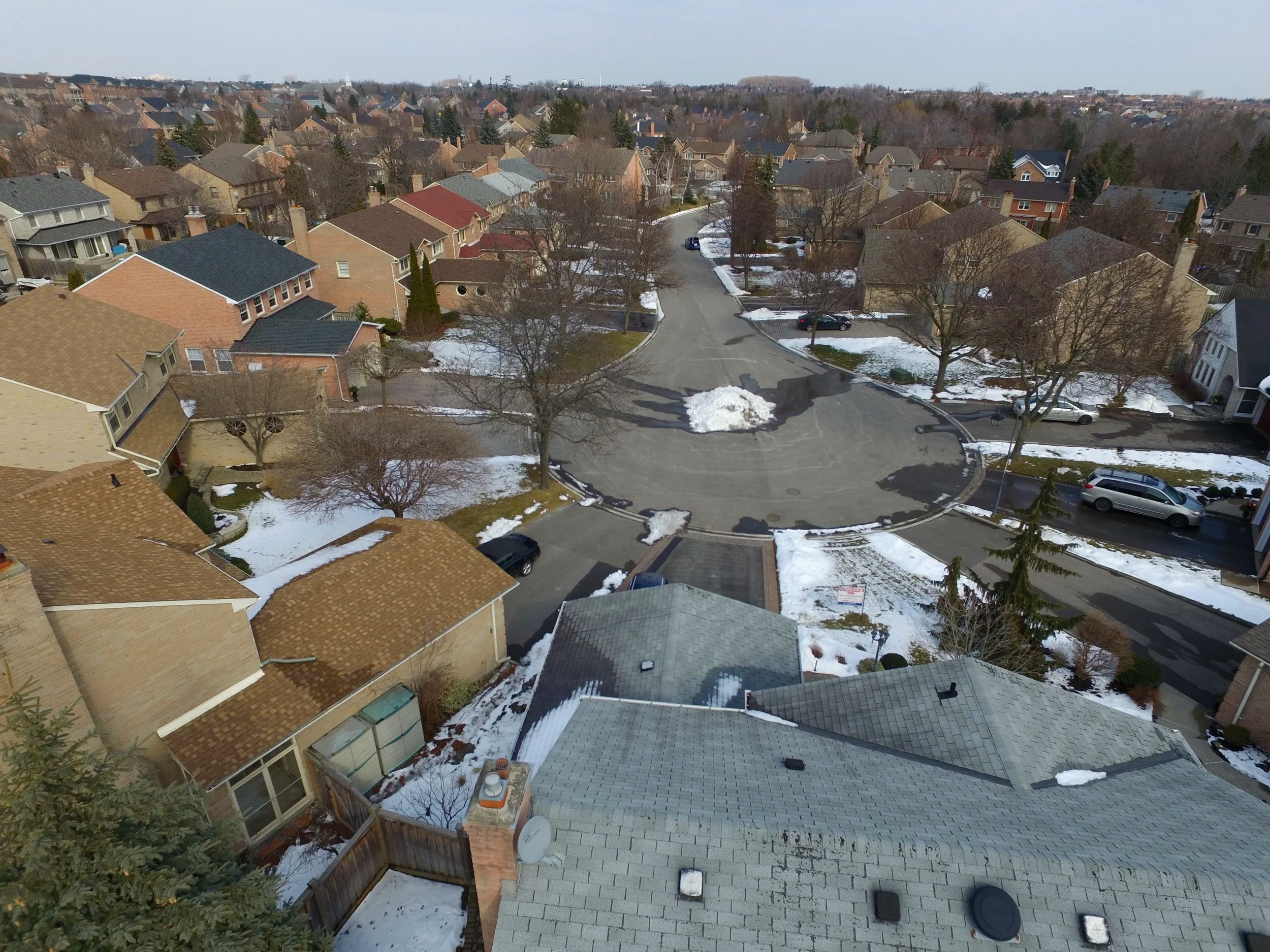
The Bridle Trail, Unionville
Your guide to The Bridle Trail
The Bridle Trail is the Unionville neighbourhood that Monarch Construction developed through the 1980s on the land between the historic village and Kennedy Road. Marketed from the start as a higher-end enclave, it remains one of the most sought-after addresses in Markham, and buyers still search for it by name. It is also home ground for us: Brad grew up at the top of Main Street Unionville, right in the Bridle Trail, and knew these streets long before he was selling homes on them.
On this page you will find the origins of the community, its streets and housing types, the Monarch model names and what they mean, and the floor plans for the Monarch homes, which we are redrawing and adding as each one is finished.
The Community
The Bridle Trail lies immediately east of Main Street Unionville and Toogood Pond, running north from Carlton Road to 16th Avenue with Kennedy Road as its eastern edge. The name belongs to the street that curves through the middle of the community from Main Street to Kennedy Road, and by long habit to the whole enclave around it. The first phase takes in Longwater Chase, Hedgewood Drive, Library Lane, Marshfield Hollow, Dalecroft Circle, Woodman's Chart, Harpers Croft, Chambery Crescent, Rosemead Close, Redwood Lane, Juniper Crescent, Waterbridge Lane, Basswood Hollow and Hastings Drive. The later phase to the north includes Springwood Crescent, Ferndell Circle, Pinebrook Hollow, Stonehedge Hollow, Greencroft Crescent, Birchview Lane, Wrenwood Gate and Wrenwood Court.

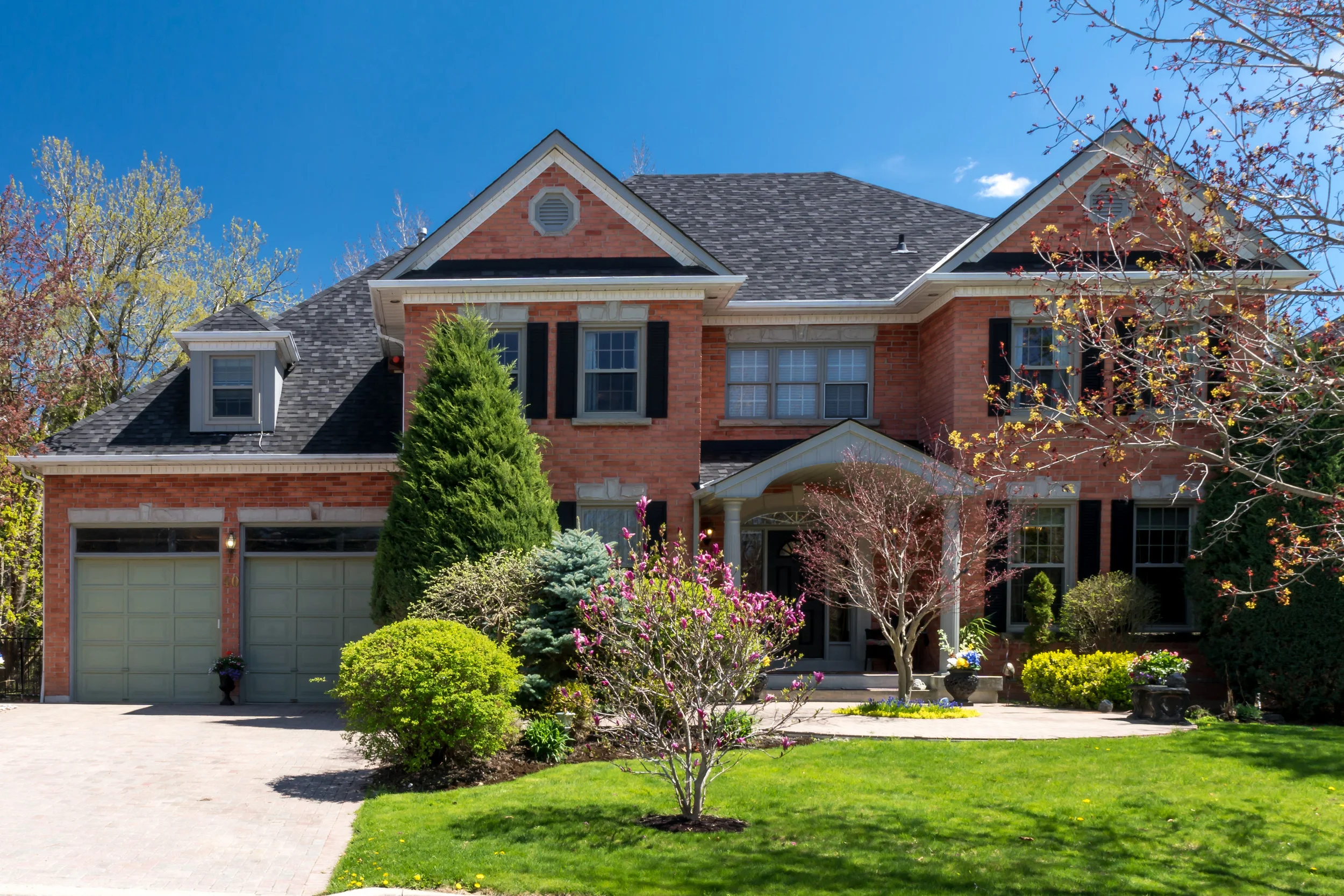

Each street entering the community is marked by a small brick entrance wall, a Monarch detail that has become the neighbourhood's signature. The plaza at Kennedy Road and The Bridle Trail appeared on Monarch's original site plan as the "Bridle Trail Centre" and still carries the name. From most of the community, the shops and restaurants of Main Street, the Unionville Library on Library Lane, Toogood Pond and Crosby Arena are a short walk away, and because the Bridle Trail streets sit just outside the Unionville Heritage Conservation District, owners enjoy the village setting without heritage easements on their homes.
One point worth knowing if you are searching listings: "The Bridle Trail" is not a community name on the Toronto board. Homes here are listed under Markham, with the community of Unionville, with the neighbourhood often identified in the remarks. Don’t fret - it’s a little confusing for anyone who’s not local.
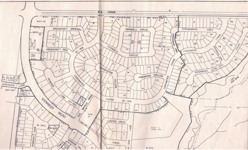
The original Bridle Trail community map
Origins of the Neighbourhood
The land became available for development because of a road. In 1965 York County approved the widening of Kennedy Road to four lanes, a plan that would have straightened Main Street's curve and removed much of the heritage village. Residents organized against it, the first Unionville Festival in 1970 was part of that campaign, and a 1975 regional transportation study recommended moving Kennedy Road east of the village centre. The new alignment was built through open farmland, and the land between the old road, which is today's Main Street, and the new one became The Bridle Trail. Monarch's 1984 site plan still labels Main Street as "Kennedy Rd. Unionville" and today's Kennedy Road as the "Unionville By-Pass".
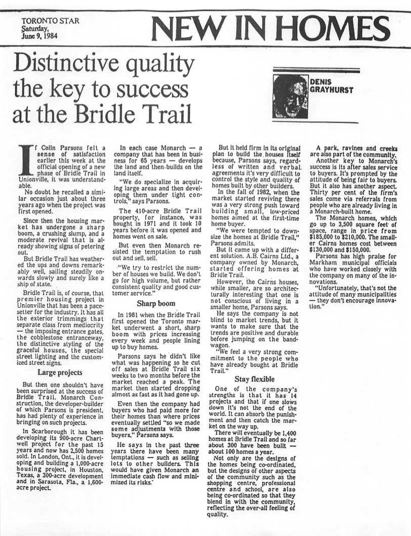
Monarch Construction had purchased the 410-acre property in 1971 and held it for a decade before opening the community in 1981. In a Toronto Star "New in Homes" column of June 9, 1984, Monarch president Colin Parsons described the company's approach: acquire a large tract, develop it under tight control, build every home rather than sell lots to other builders, and limit production to roughly a hundred homes a year so that quality and after-sales service could be maintained. By that summer about 300 homes were complete, with some 1,400 planned in total. The Star called The Bridle Trail "that premier housing project in Unionville that has been a pacesetter for the industry", noting "the imposing entrance gates, the cobblestone entranceway, the distinctive styling of the graceful houses, the special street lighting and the customized street signs".
The first phase, south of The Bridle Trail along Hedgewood Drive, Library Lane, Dalecroft Circle and Longwater Chase, was complete by 1984, and the northern phase around Springwood, Ferndell, Stonehedge and Wrenwood followed around 1987. Not every home is a Monarch. When the market shifted toward smaller homes in 1982, Monarch's affiliated company A.B. Cairns built a small number of more modest houses within the community, and custom builder John Hurlburt completed a handful of individual homes, one of them his own residence on Longwater Chase. The Hurlburt homes were known for 2x6 exterior wall construction at a time when that was far from standard practice, and they remain the distinctive exceptions in a neighbourhood that is otherwise Monarch-built.
Monarch's June 1984 price list records what a Bridle Trail home cost at the time: from $159,990 for a four-bedroom Berline to $219,990 for a Henry Summerfeldt with a deck on Hedgewood Drive. Monarch itself, founded in Toronto in 1917, was acquired by Mattamy Homes in 2015, and its reputation for build quality is the reason The Bridle Trail is still searched for by name four decades on.
Bridle Trail Housing Types
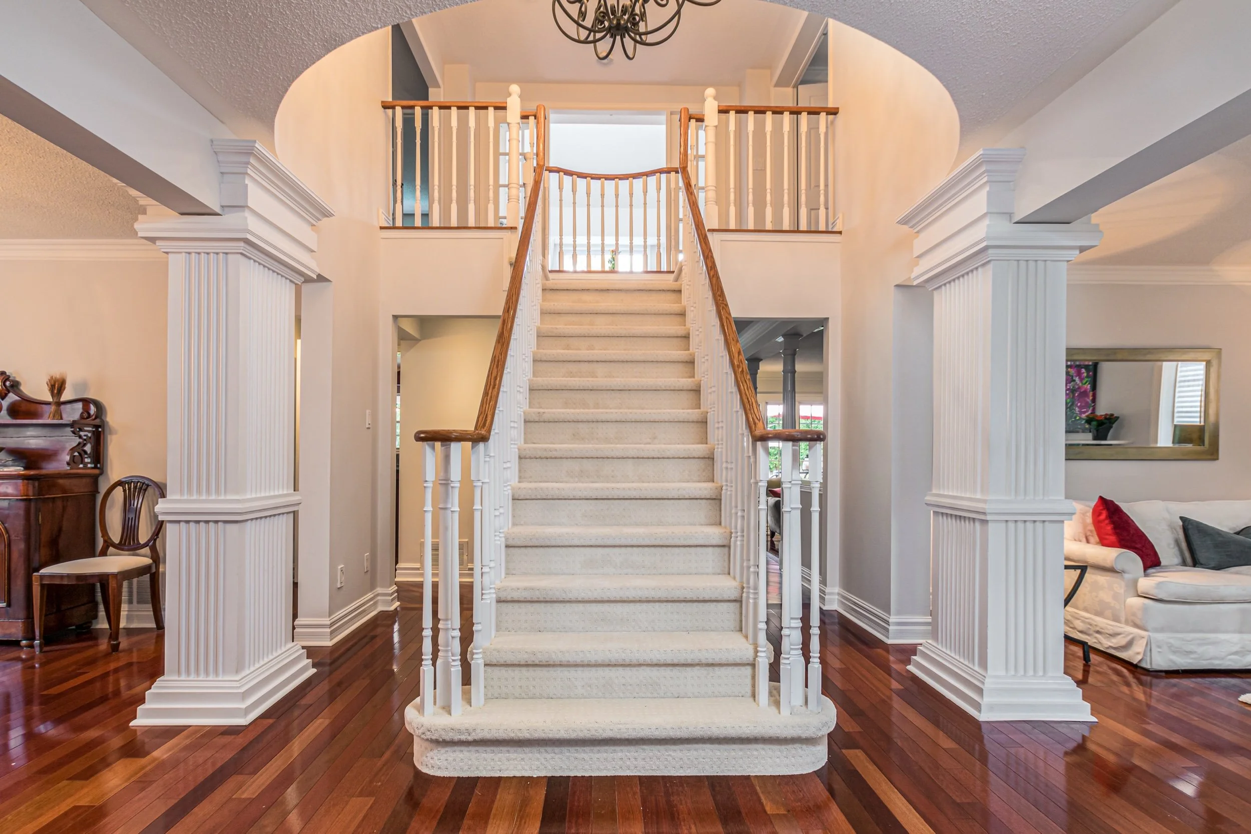
The Bridle Trail is almost entirely detached two-storey brick homes of between about 2,000 and 3,800 square feet, with four or five bedrooms, a double garage, formal living and dining rooms, a family room with a fireplace and, on the larger models, a main-floor den or library. Lots are typically 49 to 56 feet wide and 115 to 150 feet deep, with wider frontages along The Bridle Trail itself and on Wrenwood Court. Monarch marketed the homes as offering "features usually associated with custom built homes": wooden-sash windows with decorative grills, solid oak and pine cabinetry, French doors, paved driveways, finished walkways and a full landscaping package, together with a "Custom Design Features" points program that let each purchaser choose upgrades such as a whirlpool ensuite, a marble hearth or a wet bar. As a result, two homes of the same model can differ considerably inside.
Four decades on, the housing stock falls into three groups. A good number of homes remain with original or second owners and are largely as built. Many others have been substantially renovated, with additions over the garage, reworked kitchens and opened-up main floors. A smaller number have been replaced with new custom homes. Wrenwood Court and Wrenwood Gate, in the northern phase beside the ravine, are the ‘upper tier’ of the community, with the largest Monarch plans and the widest lots, and they typically set the ceiling for Bridle Trail values.
The Monarch Models
Monarch named its Bridle Trail models after the families who settled Unionville: William Berczy, who led the German Company families to Markham Township in 1794; the Eckardts, whose 1845 house on Main Street later became Fred Varley's home and studio; Robert Harrington, who ran the Unionville planing mill from 1872; and the Summerfeldts and Braithwaites, pioneer farming families remembered on the village plaque and in local street names. A second group of models carried carriage names, the Brougham, the Berline, the Victoria and the Caleche, in keeping with the horse-and-rider motif of the original marketing.
The best known of them all is the Henry Summerfeldt. At 3,615 square feet it was the largest plan in the first phase, and it was built on three levels, with a loft bedroom on the third floor at a time when a third storey was almost unheard of in a subdivision home. On a corner lot, with the three-car garage and the additional loft above it, the Summerfeldt was an enormous house for its day, and it is still the model people ask about first. The Robert Harrington was the other large plan, offered as a four-bedroom at 3,088 square feet or a five-bedroom at 3,400, while the William Berczy, at 2,606 square feet in three elevations, was the plan Monarch built most often across Hedgewood Drive, Library Lane and Dalecroft Circle. The later Wrenwood phase brought the largest plan of all, Williams House, at 3,815 square feet.
The full list of Monarch Bridle Trail models, with original sizes from Monarch's own price list and brochures, runs as follows. Sizes are approximate.
| Model | Size | Bedrooms | Notes |
|---|---|---|---|
| The Berline | 2,064 sq ft | 4 | The smallest Monarch plan in the community |
| The Mark I | 2,090 sq ft | 4 | A later-phase plan |
| The Avery Bishop | 2,100 sq ft | 4 | Offered in two elevations |
| The Caleche | 2,100 sq ft | – | On the 1984 price list |
| The John Stephenson | 2,272 sq ft | 3 or 4 | |
| The Mark Braithwaite | 2,343 sq ft | 3 or 4 | Two second-floor layouts |
| The Victoria | 2,300 to 2,400 sq ft (approx.) | 4 | |
| The Salem Eckardt | 2,404 sq ft | 4 | |
| The William Berczy | 2,606 sq ft | 4 | Elevations A, B and C |
| The Thomas Lounsbrough | 2,621 sq ft | 4 | |
| The Brougham | 2,900 sq ft (approx.) | 4 | |
| The Robert Harrington | 3,088 sq ft (A) · 3,400 sq ft (B) | 4 or 5 | Elevation B is the five-bedroom version |
| The Henry Summerfeldt | 3,615 sq ft | 4 + loft | Three levels; the Summerfeldt II is the same plan mirrored |
| Williams House | 3,815 sq ft | 4 | Wrenwood Court |
| The Lonsdale | – | 4 |
Monarch did not assign models to streets in any systematic way, so the same plan appears on Hedgewood Drive, Library Lane and Dalecroft Circle alike, and the exterior elevation is not a reliable guide to the layout inside. If you are unsure which model your home is, we are glad to identify it.
Amenities, Schools and Transit
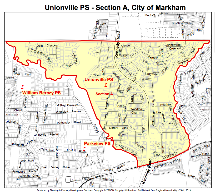
Unionville Public School Catchment area 2016
Main Street Unionville, with its restaurants, shops, the Varley Art Gallery and the Crosby Memorial Community Centre, is a short walk from most of the community, as are Toogood Pond Park, the Unionville Library and the trails along the ravine. Markville Mall and the Markham Civic Centre are minutes away by car. For commuters, Unionville GO Station on the Stouffville line and the Viva rapidway along Highway 7 are both close at hand, with Highways 407 and 404 a short drive.
Two elementary schools sit entirely within the community: Unionville Public School on Main Street, one of the oldest schools in Markham, and St. Matthew Catholic Elementary School. School boundaries are set by the boards and can change from year to year, so families should confirm the designated schools for a specific address with the York Region District School Board or the York Catholic District School Board.
Frequently Asked Questions
Is The Bridle Trail in Unionville or Markham? Both. Unionville is a community within the City of Markham, and The Bridle Trail lies on the east side of the historic village. Postal addresses have read "Markham" since the early 1990s, though Unionville was reinstated as a valid address for the area in 2009 and remains the name residents use.
Who built The Bridle Trail? Monarch Construction, which purchased the land in 1971 and opened the community in 1981. A small number of homes were built by Monarch's affiliated company A.B. Cairns and by custom builder John Hurlburt.
When were the homes built? The first phase was under way from 1981 and largely complete by 1984; the northern phase, including Wrenwood, followed around 1987.
What are the Monarch model names? The pioneer-family models are the John Stephenson, Salem Eckardt, Thomas Lounsbrough, William Berczy, Henry Summerfeldt, Mark Braithwaite, Avery Bishop and Robert Harrington. The carriage-named models are the Brougham, Berline, Victoria and Caleche, and the later plans include the Mark I, the Lonsdale and Williams House.
Is The Bridle Trail within the heritage district? No. The Unionville Heritage Conservation District covers Main Street and the village core; the Bridle Trail streets lie just outside its eastern boundary, so these homes carry no heritage easements.
Can I obtain the floor plan for my home? Our drawings are redrawn from Monarch's original marketing plans and show each model as designed, not as any particular house was finished or later renovated. For owners preparing to sell, we measure and draw the home as it stands today.
Considering a Move to The Bridle Trail?
Whether you own a Bridle Trail home and would like to know what it is worth in today's market, or you are hoping to buy into the neighbourhood, we would be pleased to help. We have sold homes on most of these streets over the years, we hold the original Monarch plans, and we know what separates an original home from a renovation or a rebuild when it comes to value. Contact The MAC Team or request a free home value consultation to get started.